037
- Description: Find out where the photo was taken. Flag:
HMV{XX.XXXXXX,XX.XXXXXX}
🔎 Solution
The objective of this challenge was to determine where the image was taken.
I started by checking whether any geolocation metadata was embedded in the file.
Using exiftool returned usable GPS coordinates:
> exiftool osint.jpg
GPS Altitude                    : 25 m Above Sea Level
GPS Date/Time                   : 2016:07:25 18:44:29Z
GPS Latitude                    : 58 deg 58' 2.87" N
GPS Longitude                   : 18 deg 18' 59.03" E
Focal Length                    : 4.2 mm
GPS Position                    : 58 deg 58' 2.87" N, 18 deg 18' 59.03" E
Light Value                     : 14.3
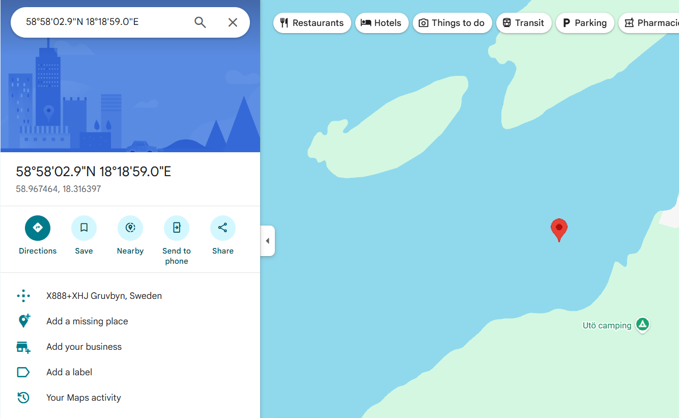
Searching these coordinates on Google Maps showed that the location is in Gruvbyn, Sweden, at approximately:
58.967464,18.316397
Since GPS coordinates are approximate, the exact answer for the challenge is:
58.967463,18.316396
🚩Flag
HMV{58.967463,18.316396}